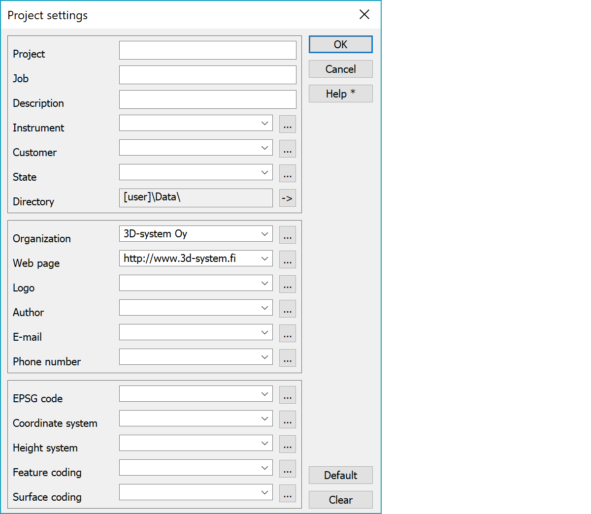
Project settings contain genereal information about the project and author. All fields are simple text values.
Information is used in files with macros starting with character # (e.g. #PROJECT). Macro value is first searched from converter project settings and if it is not found there, from the active project settings. If there is no active project or the data is not defined there, value is searched from global project settings.
Coordinate system definitions required by some formats (E.g. LandXML, Shape, MapInfo) can be given here. Definitions in the fields EPSG code, Coordinate system and Height system are written to appropriate locations according to the format. Some formats may add their own definitions to drop down lists.
With plane coordinate systems fields EPSG code and Coordinate system accept value asterisk (*). Format writing tries then automatically recognize the coordinate system based on the east coordinate value of the center point of the written file. This mechanism can recognize commonly used finnish coordinate systems WGS84, TM35, KKJ and GK. If the EPSG code has fixed value and the coordinate system is an asterisk, the official name of the EPSG system is used as a coordinate system name.
Likewise Feature coding and Surface coding can be asterisks (*), which are replaced by used code file name in format writing.
List fields remember last 20 values and list contents can be edited with adjacent browse buttons.
Directory field cannot be changed. It displays always the project file directory. Adjacent arrow button opens the directory in Windows file explorer.
Logo setting defines raster image file name in title files and HTML-format templates.
If the coordinate system is asterisk (*), name is determined by the EPSG code. If the EPSG code is asterisk (*), the code is determined automatically from the file coordinate area. This works only for common finnsh coordinate systems (KKJ, GK, TM).
Gets global default settings.
Clears all values.
Macro names are following:
| Macro | Description |
|---|---|
| #PROJECT | Project name |
| #JOB | Job name |
| #DESCRIPTION | Project description |
| #INSTRUMENT | Instrument |
| #CUSTOMER | Customer name |
| #STATE | Project state |
| #DIRECTORY | Project directory |
| #ORGANIZATION | Organization name |
| #URL | Web site address |
| #LOGO | Organization logo |
| #AUTHOR | Author name |
| E-mail address | |
| #PHONE | Phone number |
| #EPSG | Coordinate system EPSG code |
| #COORDSYS | Coordinate system name |
| #HEIGHTSYS | Height system name |
| #CODESYS | Feature coding |
| #SURFACESYS | Surface coding |
There are some special settings related to this function.
Maximum amount of recent values in the lists. Default 20.
See also: Using special settings