MapInfo transfer file consists two different ASCII-files: geometry (.MIF) and attribute data (.MIF). All objects in geometry file have always same attributes in MID-file. By default, converter reads MID-file contents to point or line attributes and writes code fiels T1-T6 to MID-file. Control file can be used for more exact attribute and code field handling.
Used coordinate system can be written to the beginning of the MID-file by defining it in the project settings. Know systems are written with their own parameters. Unknown systems are written with the default header by using just system name. The whole header can be replaced by giving it as a seed file.
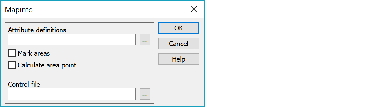
GIS-attribute type definitions needed for writing. If no definitions are given, code fields T1-T6 and point height (Z) will be written.
Marks closed breaklines as areas.
Calculates area point for closed breaklines. The calculated point is always inside the area.
Control file for color, symbol and line type handling.
Colors, symbols and line types can be defined either in code file or specific control file.
Symbology in MIF-file is defined in this order:
In Special settings you can define another control file, to control the symbology. This file is a text file and it includes symbology for the points, lines and texts. In control file Mapinfo's own symbols and linetypes can be used.
code 0 symbol color size
code 1 type color width
code 1 type color width raster_type
code 3 style color typeface
A RGB-color is given as a single value:
RGB = red*65536 + green*256 + blue
where the colors (red, green, blue) can be found in e.g. Windows color selection dialog (you can use 3D-Win color settings to reach this dialog).
Examples of RGB-colors:
If the control file does not have the codes/symbolics needed, they will be added automatically at the end of the conversion (see MissingCodes-Special setting). The Log file will have a line for this and you need to check the new codes/symbolics. The new lines will be separated with a comment line (// -----).
If you use control file, program tries to find a line with same type/style and color as object to read. If line is found, the feature code (first value) is copied to the object (T3-field). If line is not found, the symbology is copied to the object (color, line type, width, etc).
Example of a control file:
! MapInfo control file
  0 0  34       0 12
 90 0  58   65280 24
141 1  6      255  3  0
202 1  2 16711680 16  5
131 2 50      255  1  3
272 3  7 16711680 "Courier New"
There are some special settings related to this converter.
Writing line height into MID-file.
You can write line heights into MID-file as attributes by using special setting LineZattr. The same definitions must be added into the GIS-attribute file. Define attributes separated by comma: attr1,attr2.
If the control file does not have the codes/symbolics needed, they will be added automatically at the end of the conversion.
Bounds line minimum and maximum value handling in writing.
See also: Common special settings