Arcview 2D and 3D shapefiles. Format consists three different binary files: Geometry (.SHP), attribute table (.DBF) and index file (.SHX). One file group contains always only one geometry and feature type. So, points, lines and all features containing different attributes are stored to separate files. DBF-file may be missing in which case just geometry is read without attributes.
Reading recognizes different geometry types automatically. Written geometry type is selected in settings dialog below. Additionally, if all lines in file are closed, they are written as POLYGON types.
By default, attribute data from the DBF-file is read to point or line attributes and writing stores code fields T1-T6 to the DBF-file. Control file can be used for more exact attribute and code field handling.
Used coordinate system can be written to the separate PRJ-file by defining it in the project settings.
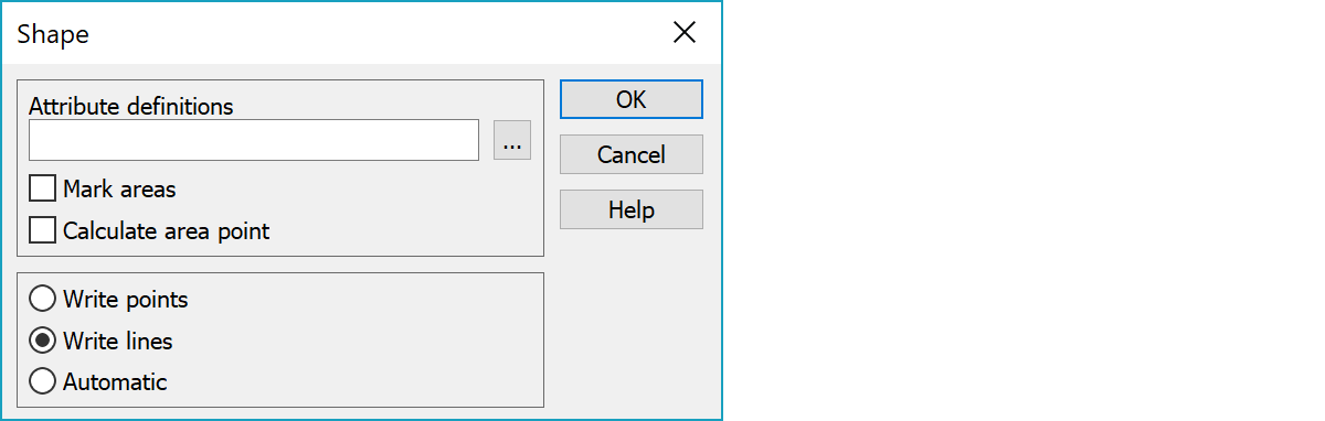
GIS-attribute type definitions needed for writing.
Definition file can contain multiple definition blocks starting with title line in square brackets. Title is either code or search rule (e.g. [121], [3??], [#TYPE=POINT]). If no definition matches to first item in the written file, first definition is used by default.
Marks polygon based closed breaklines as areas.
Calculates area point for closed breaklines. The calculated point is always inside the area.
Determines if point or polyline file is created. Automatic option writes points, if the file has no breaklines. Otherwise lines are written by default.
There are some special settings related to this converter.
You can write line heights into shapefile as attributes by using special setting LineZattr. The same definitions must be added into the GIS-attribute file.
attr1 = attribute name to hold height of a line start point in 3D.
attr2 = attribute name to hold height of a line end point in 3D.
To reset attribute value after every point and not copy the value as default value.
See also: Common special settings