 Make road measurement line Make road measurement line
To create a road measurement line using a road file (horizontal alignment). Line points will get height from the vertical alignment and code will be set to 9070 to control the color and line type in drawing.
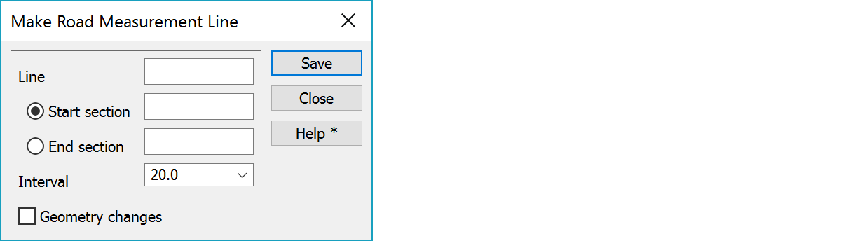
Measurement line number.
The starting and final chainage points can be given manually or with the mouse. Mouse coordinates are rounded to the nearest chainage value. If no chainage is given, the first and last chainage points of the measurement line will be used.
Chainage interval to be used between the start and end point.
Measurement line will contain also all start/end sections of arc/chlotoid.
See also:
There are some special settings related to this function.
A comma separated list of section intervals in selection list.
Section marker line length in meters. If the value is negative, the line is drawn to both sides of the measurement line.
See also: Using special settings