 Profile comparison Profile comparison
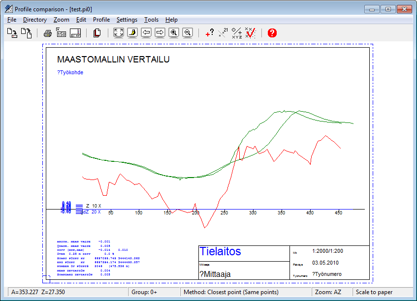
The terrain model compare function has been created to meet particular requirements of the Finnish Road Administration. Select or show a line. The profile will be calculated for this line and then a comparison made to the terrain model. Calculation results for every line are also stored in a result file, which you can open using Report-function in Settings.
Comparison settings.
A control line measured in the terrain is used for checking the accuracy of the terrain model. This control line is measured by accurately imitating the terrain, as with the terrain model but with one continuous line, covering as much of the given area as possible. The lines are generally straight and coded as control lines.
From this control line a profile is calculated. Then, from the terrain model a profile is calculated in the same position as the control line. The two profiles are drawn in the same picture (distinction diagram) and compared, with a given Z factor, and certain comparison results are calculated.
See also: Cross section and profile window drawing.