 WMTS Browse WMTS Browse
Function allows raster map browsing from web services using WMTS protocol. Every time the screen zooming is changed, new window size image is fetched from the service. The usage speed is dependent on fetched image size, fetch resolution, network connection speed and service speed. New connection is configured with Add-button.
Network settings can be found under file settings.
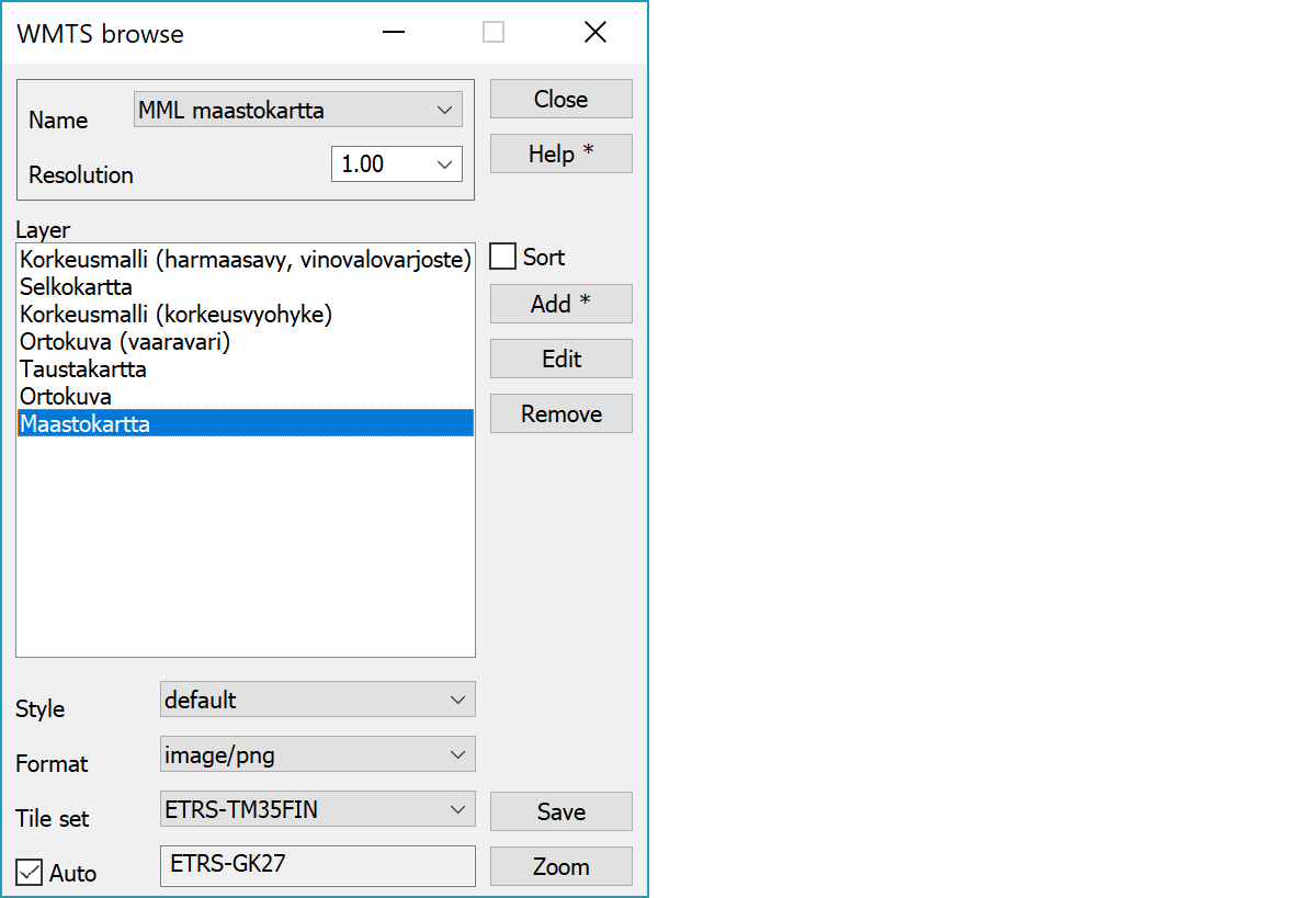
Connection selection.
List can be used to select image resolution scale for faster browsing. Value 1.0 represents screen pixel and smaller values decrease quality. For example, value 0.5 halves image resolution.
List of image layers offered by service. Only one layer can be selected for displaying.
Layer display style and fetched image tile format.
Coordinate system defining tile set. List contains all sets available for selected layer.
Auto-setting selects used tile set automatically. If tile set matching with user coordinate system is found, it is used directly. If matching tile set is not found, set selected in the list is used. In both cases field beside the checkbox displays used tile set name. Use of matching tile set is faster, because there is no need to make coordinate transformation for fetched map tiles.
Displays map layers either in service defined order or alphabetically sorted.
Adds new connection and opens its settings. With Shift-modifier current connection settings are copied.
Opens connection settings for editing.
Removes current connection.
Saves current screen area image to the element list file using resolution defined in connection settings.
Zooms screen to the selected layer area.