 WMS Fetch WMS Fetch
Function allows raster map fetching from web services using WMS protocol. New connection is configured with Add-button.
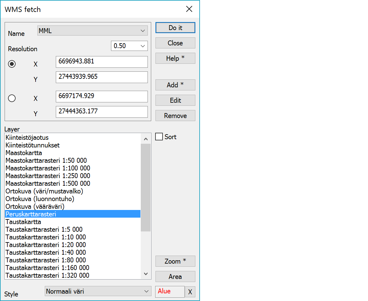
When fetching maps, the connection is first selected from the list on top. Rectangle corner coordinates is given with mouse and layers selected from a list. Fetched raster map file is added to the element list.
Network settings can be found under file settings.
Connection selection.
List can be used to select image resolution scale for faster browsing. Value 1.0 represents screen pixel and smaller values decrease quality. For example, value 0.5 halves image resolution. If the maximum image size is set in settings, scale is adjusted automatically so, that the fetched raster map has bes possible resolution.
List of service image layers supporting coordinate system selected in settings. If the service supports layer combining, several layers acn be selected here with Shift or Ctrl modifier keys.
Drop down list below layers displays supported styles, if available.
Displays map layers either in service defined order or alphabetically sorted.
Adds new connection and opens its settings. With Shift-modifier current connection settings are copied.
Opens connection settings for editing.
Removes current connection.
Zooms screen to the selected layer area. This requires that the service capabilities file contains layer area in used coordinate system.
With Shift-key finds smallest scale layer and zooms to it. This can be used as a starting layer for browsing.
Starts fetch area pointing mode.
Field displays current mode. X-button quits the mode and returns to the normal state. X-button with the Alt-key makes dialog inactive. Inactive dialog remains visible, but does not react mouse pointing. Pressing the X-button again activates dialog.