 Model settings Model settings
These terrain model settings affect all models and square net files.
Color legend can be displayed in the title file with the COL-definition.
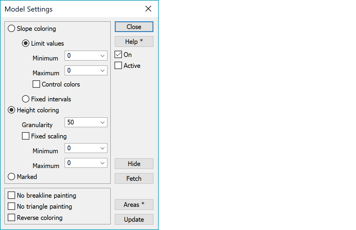
Colors triangles based on their slope. Steeper slopes get darker color. Does not work with square net.
Minimum and maximum can be used to limit coloring only for triangles with specific slope values.
Uses control colors for slope values below, between and above given limits.
Uses fixed colors for slope values between given intervals. Slope interval values are given in the special setting SlopeIntervals.
Colors triangles or squares based on their height using full color spectrum.
Determines how many parts the painted height interval is divided. Negative value is interval in meters.
Fixed scaling minimum and maximum values can be used to scale coloring for given height interval. Without fixed scaling minimum and maximum are searched automatically from all element list models in use.
Colors marked triangles based on their code. Triangles can be marked by model editing flat area and spike search functions.
Model breaklines are not painted.
Model triangles or square net squares are not painted with coloring.
Color order is reveresed.
Dialog settings are only on if this checkbox is on. Selecting settings with the Ctrl-key just switches this on or off.
Settings are used only for active file.
Hides triangles outside given slope or height limits. With height limits triangle is hidden if its center height is outside limits. Hiding can be made accurate by adding limit countours to the model before hiding.
With the Alt-key hides triangles inside given limits.
Fetched the minimum and maximum values from the model for either slope or height depending on the currently active setting.
Saves painted areas to a new vector element. With the Shift-key creates areas without colors.
Updates the screen.
There are some special settings related to this function.
Slope interval values for fixed interval coloring in comma separated list.
See also: Using special settings