 Height from model Height from model
Finding a height from the terrain model. The model can be a terrain model or a difference in surface height. You can e.g. get height for the digitized points, calculate pole lengths from the to of the pole to the rock bottom or make control measurements.
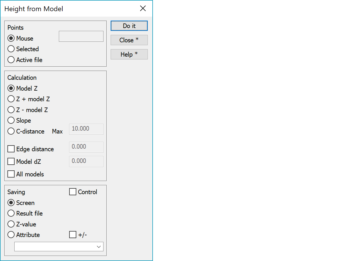
Points to be calculated can be either
When moving cursor while pressing the button of the mouse together with the SHIFT button, you can get continuous height reading.
Calculation result can be either
Max is maximum distance with the C-distance.
Makes it possible to find height outside of the visible model. If the point position is within given distance from the model, height is extrapolated from the nearest visible triangle.
Value added to the model height.
Searches height from all used models in the element list and uses model with smallest height difference to the calculated point.
The results can either be
Last two options are available only if you use actual point and not just mouse point.
Control saves result values as a control attributes to original points. If calculation option Slope or C-distance is selected, it is stored as a control. Otherwise distance to model (Z - model z) is stored. Other options are not available. Control arrows are drawn according the control measurement settings.
Setting +/- stores sign character to attribute also for positive values.
There are some special settings related to this function.
List of code field and attribute names.
Attribute name used to store original height of modified point. Used with Z-coordinate option.
See also: Using special settings