 Stakeout Stakeout
With this function points can be set out in the terrain with GPS.
xxx
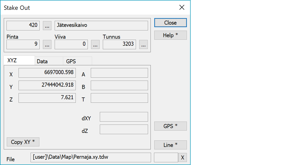
Upper part fields display object type and three freely selectable attributes.
Point coordinates. A and B are projected section and side offset from the reference line, if available. T is a point symbol direction in gons.
Copies coordinates to the clipboard as a comma separated text. By default copies only X and Y. With the Shift-key the Z is also copied. With the Alt-key decimal separator comes from system settings and field separator is tabulator. This format can be pasted directly to Excel columns as numeric values.
Activates the data copying from another object. The other object containing data is pointed by the mouse. By default only the object code is copied. With the Shift-key all attributes are copied. With the Ctrl-key only text is copied.
xxx
Displays current edit mode (move, rotate, add, etc.). The X button quits the mode and returns to the normal state.
There are some special settings related to this function.
Settings affecting edit and calculation function behavior.
Defines which attributes are displayed first in the list. By default T1,T2,T3,T4,T5.
See also: Using special settings