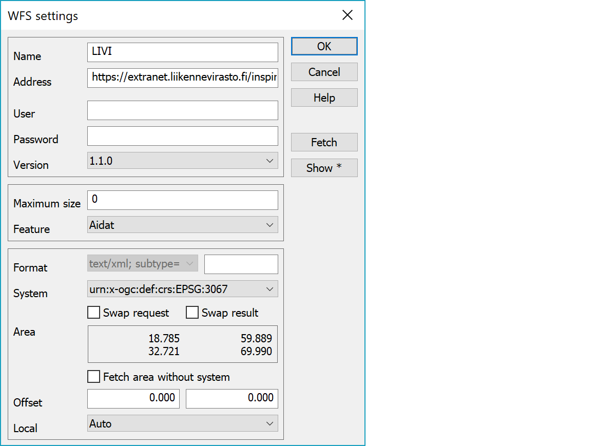
Service capabilities and settings handling. At least capabilities address and possible HTTPS setting are needed for service definition. Additionally username, password and service version could be required. After these defintions, Fetch-button retrieves other information from the service.
User defined connection name
Service capabilities address.
Service username and password.
Password is displayed in dialog as asterisks and it is crypted with program's licence number in the settings file. If the licence number changes, password must be entered again.
Service version number is negotiated based on user request and supported services. If user requested service is available, it is used. Otherwise nearest supported version is used.
Supported versions are 1.0.0 and 1.1.0.
Default format is GML. Second field can contain file extension added to the file name for use with format converter selection. See GML-format for more information.
Maximum amount of features fetched. Service determines the default value, but user may temporarily use lower amount.
List of all feature types available in the service.
List of coordinate systems supported by the selected feature. Services use internally east-north coordinate order by default and the program swaps coordinates automatically to current system. If the service uses different coordinate order, the Swap request setting can be used to swap XY coordinates. Likewise, the Swap result setting can be used to swap XY coordinate order in the result file.
For a list of known coordinate system codes, see Zone-function.
Coordinate area covered by the selected feature in geographical degrees.
Used coordinate system definition is not added to the fetch area request in WFS versions 1.1.0 and newer. Needed with some WFS-servers.
Coordinate offset added to the fetch rectangle.
Local coordinate system determines the user coordinate system. By default it is empty, which means that the service coordinate system is used directly. Otherwise the area is converted from the user system to the service system before fetch and the returned file is transformed back to the user coordinate system. Auto option tries to recognize the user system automatically by using false easting value of some common coordinate systems (KKJ, TM, GK).
Makes new capability request.
Shows service capabilities file wfs.xml using the system default program. With Shift-key displays file in the text editor.