 Square grid Square grid
The square net is created to aid visualization of the terrain model. The square net is clearer to the human eye in three-dimensional view than the triangle net. A new file element is created for the square net and can be saved normally.
Square net is separate file type, which can be saved as a DXF surface model using File/Formats/Write/Dxf.
It is good to try the square net with different square sizes and orientation values. They are dependent on the model size and shape. With experience, choosing the values becomes easier. Usually, best results are achieved showing same time the square grid and original vector file break lines.
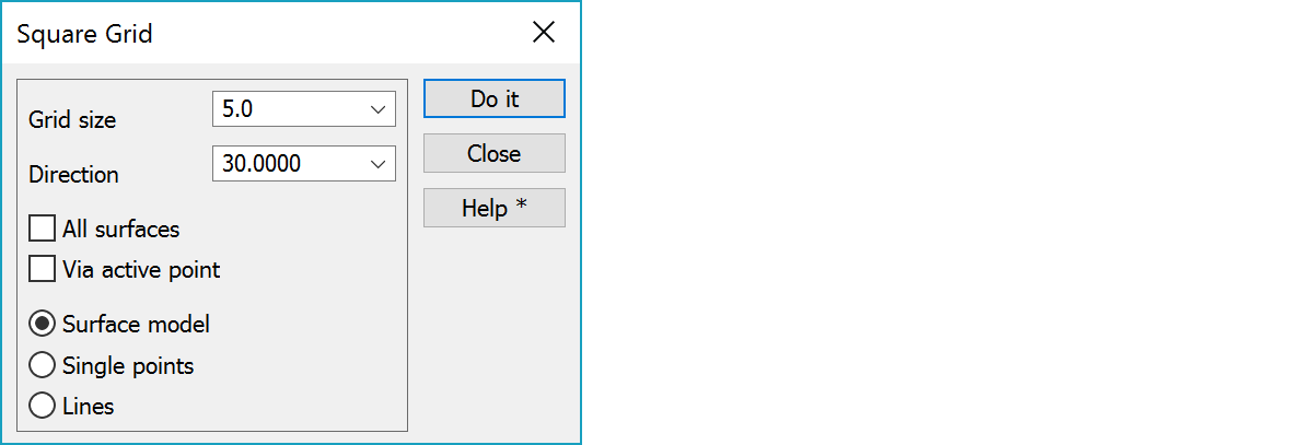
Square size in meters.
The square net’s orientation angle. Value can range from -50 to +50 gons.
The square net is calculated from all the models in use. The result will be separate file for each model.
Creates square net so, that lines go through the active point.
First option creates surface model, which can be moved to CAD-programs as a surface. Others create normal vector file either as single points from square corners or as crossing breaklines.
If the file is created as single points and model coloring is on, model color is stored to point draw data and the file is drawn and golor grid.