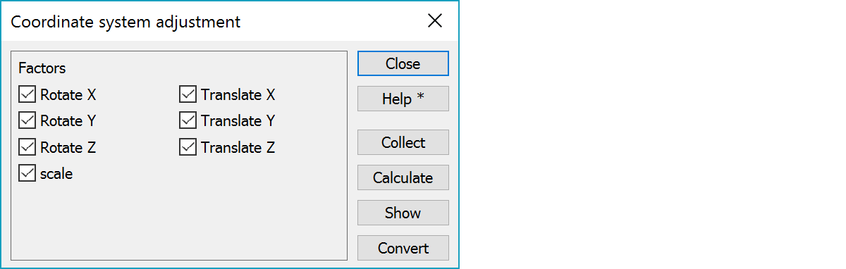
Coordinate system adjustment defines factors for transformation. Select common points in old and new coordinate system. The factors are saved in a file for possible later use.
Adjustment is calculated using least square method. You can see the residuals for every point after adjustment. You may change the settings and/or add/remove points and recalculate the adjustment.
Adjustment can be controlled using the factors. Factors can be abled/disabled individually. In normal case all factors are abled.
Select corresponding points. You can collect the points, calculate and return to Collect-function to add, remove, change points.
Calculation using the corrsponding points and selected factors. Calculation is done in an external software and there is a beep to tell about the ongoing calculation.
When calculation is finished, you can save the parameters in a file.
Calculation results show residuals for every point, maximum values and the calculated parameters. Results are shown in text editor and you can print or save the results.
Converting active file using the calculated parameters. File name is confirmed before conversion. After the conversion you can calculated the residuals. The first two files in element list are used.
Example of result file:
3D-system Oy                        10.04.1999  12:09

Residuals

      Nr          dX          dY          dZ        dXYZ
     505       0.362      -0.075       0.223       0.432
     350      -0.137      -0.207       0.059       0.255
     510      -0.201       0.517      -0.084       0.561
     119       0.112      -0.029      -0.257       0.282
     350      -0.137      -0.207       0.059       0.255

max            0.362       0.517       0.257       0.561

Parameters
       RotX       RotY       RotZ         dX          dY          dZ    scale
   -61.3044    -2.2274   181.5254  44698.475  -39265.423    1306.691    1.000285