 Cross section control Cross section control
Compares measured crosssection to a cross section calculated from terrain model. Cross section is measured as breakline.
There is more information and testdata in 3D-Forum: Cross section control
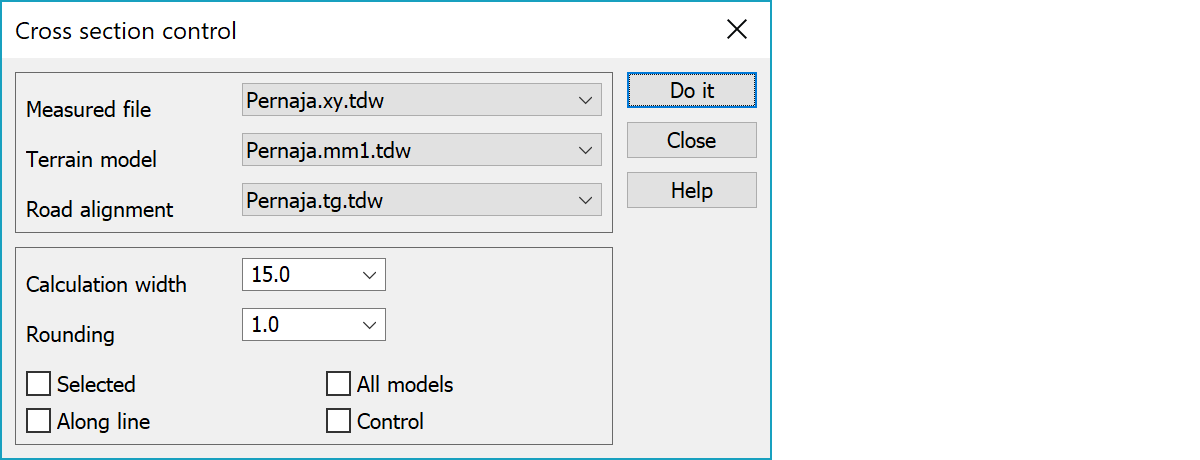
File that contains measured lines. Line can be measured from left to right or vice versa. Lines should have same surface id as used terrain model.
Terrain model for the theoretical surface.
Center line of the road.
Width for the cross section calculated from the terrain model.
Rounds calculated section position to given value.
Only selected lines are calculated. Line is selected if any of it's points is selected in the group.
If checked, cross section is calculated along the measured line. Otherwise the points are projected perpendicularly to road alignment. Theoretical cross section is calculated along same line. Cross sections section number is mean value of it's endpoints.
Laskee poikkileikkauksen kaikista elementtilistan malleista. Vertailu suoritetaan kuitenkin vain listalla valittuun malliin.
If checked, height difference (DZ) is stored as control point to the measured point. Viivasta lasketaan aina poikkileikkaus kuvaan. Jos rasti on päällä, lasketaan myös tarkkeet.