 LandXML handling LandXML handling
Function divides LandXML-file to separate parts. Each terrain model and road alignment forms separate file, which can be read directly to the program. Files are created to the subdirectory, which have same name as the original file name without extension. Separate files are named according to their group and name in the original file. Files use multiple extensions based on their type (for example, *.tg.xml for road alignments and *.mm.xml for terrain models). These multipart extension can be used in format converter definitions to recognize file type automatically.
File contents can also be read to the element list directly using separate open function.
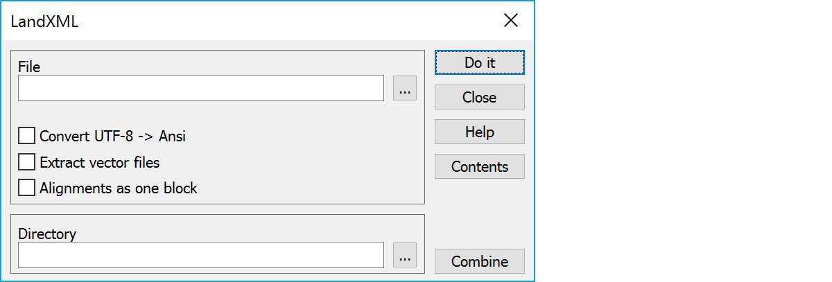
Divided file name or multiple files with wildcards. If subdirectory already exists, confirmation is asked before clearing it.
Convert character set from UTF-8 to Ansi.
Copies extracted part also to vector file, if it has suitable content. Examples of these are terrain model SourceData-sections (original triangulated data) or Irregular-type road alignments (actually breaklines). This makes it easier to open file as a vector file, but may cause problems when combining extracted files back together, because the original file and vector file both have same id.
Extract all alignments inside same Alignments block to single file.
Last combined directory.
Lists LandXML file contents to the text file landxml.txt in the user settings directory and opens it in the editor.
Combines several LandXml files together. Function first asks original files and then the result file name. Header information is copied from the alphabetically first file and files are appended together without any content checking. This means that the validity of the result file cannot be guaranteed unless all original files are written by the same application and with same settings.